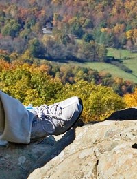
The path grew narrower, the drop offs more abrupt. A plunge from this height would do major damage to internal organs.
The Ozarks is one of “the most backward and deliberately unprogressive regions of the United States,” declared Vance Randolph, a noted folklorist and Ozark native. Journalist Dorinda Fox remarked that “Arkansas has been a backwater for 400 years. Parts of it, like the Ozark Mountains, were probably backwaters for a lot longer than that.”
The Ozark Mountains have a reputation for being remote, poor and impenetrable. So what was I doing there with a handheld GPS, a TrekPod carbon fiber walking staff, and a Canon PowerShot 14.1 Megapixel camera? I was geocaching, of course.
What the Heck is Geocaching?
Geocaching started in 1993 when then President Bill Clinton made the Global Positioning System (GPS) available for public use. Within months an enterprising hiker named Dave Ulmer hid a small stash of trinkets in the woods near his Oregon home and posted its coordinates online, daring others to find it. Using GPS, they did. Before a week was out, the hobby had caught on. Stashes were being hidden all over the United States and in Europe and Australia. Geocaching was born.
Geocaching involves finding small containers of trinkets using a handheld GPS unit that indicates direction and distance. The unit is like a high tech compass, pointing the way and ticking off the distance in miles and feet as you close in on the object.
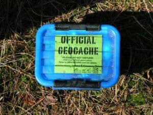
The object or “cache” is usually a Tupperware container or an ammunition box holding a log book and random junk like plastic promotional dolls, beads, buttons, magnets and matches.
Certain customs and rituals apply. You should always sign and date the log book, adding your name to what is sometimes a long list of others who have found the cache before you. And you should take nothing from the cache unless you add something of equal or greater value, which usually means whatever random junk you happen to have on you.
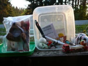
The object or “cache” typically holds a log book and random junk like promotional toys and other stuff.
Caches must always be hidden in a way that they can be seen. Caches should never be buried, although they can be hidden in a knot hole, stuck to the bottom of a park bench or hung from a branch. And you should never, ever remove a cache after finding it.
If you want to hide a geocache, place it and then go home and enter its coordinates on one of the sites devoted to geocaching like Geocaching.com. Others will come to the site, download the coordinates and try to find it.
That’s where I found the hidden cache at the Knife’s Edge.
You Have Been Forewarned
I was specifically looking for a cache that would be challenging to reach. I wanted to combine a rigorous hike with the adventure of locating the treasure. I was headed to the Ozarks so I entered the zip code for Jasper, Arkansas and got 85 search results. If that seems like a lot of geocaches for just the Arkansas Ozarks alone, consider there are over 5 million geocaches hidden worldwide in over 100 countries and seven continents, including Antarctica. The hobby is an international phenomenon. Wherever you are in the world, a geocache is likely hidden nearby.
I looked through the list and zeroed in on The Knife’s Edge because it had a difficulty score of 3 and a terrain score of 4. Every geocache is graded on a scale of 1-5, the higher the score, the greater the challenge. The Knife’s Edge would not be easy to find. And it would be tough to get to.
The person who hid the cache had this to say about it on the Hints page:
CAUTION: This cache is not for those who are bothered by vertigo or have a fear of heights. The final approach is narrow, varying from 5 feet to 10 feet wide, with uneven footing and sheer dropoffs of greater than 50 feet on either side. A slight misstep and death or severe injury is certain. You have been forewarned. Proceed at your own risk.
I was ready to go.
Jasper, Arkansas: A Big Town in the Ozarks
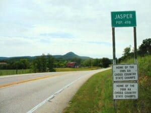
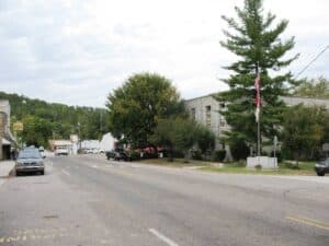
The town of Jasper, Arkansas is nestled deep in the Ozark Mountains of northern Arkansas. With a population of 498 it’s one of the most populous towns in the region.
The Ozark Café, a historic eatery established in 1909, is a favorite haunt of weekend bikers and bluegrass aficionados. Attached is the Front Porch Inn, the only place to stay in downtown Jasper, boasting three rooms. It’s flanked by Emma’s Museum of Junk and across the street from the Newton County Jail. Down the street is the rusted marquis of the old Buffalo Theatre, a long defunct cinema that challenges the idea of how small a movie theater can be. From anywhere in Jasper you can see the thickly forested prominence of Round Mountain. The narrow path that ascends to the top resolves itself into a precarious catwalk known as The Knife’s Edge. That’s where I was headed.
I turned on the GPS as I was driving toward the mountain. It read 2.5 miles. By the time I got to the trailhead just off Route 7 south of Jasper, it was telling me it was a mere 0.8 miles to the cache. But there was a problem. The trailhead was closed. A No Trespassing sign had been posted. As it turns outs, the previous autumn a large section of the mountain had sheared off, destroying the trailhead facilities and the parking area. The mountain was unstable. But I didn’t know that at the time. So I disregarded the sign and kept going.
A Hike up Round Mountain
I climbed the trail a little way to the bluff line of Round Mountain. The trail looped around the base of the mountain. The gradual ascent was nothing like I’d expected and I was a little disappointed until I saw the arrow on my GPS swing around to the right. The distance was starting to increase.
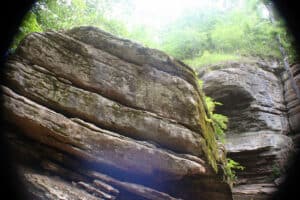
This meant I was moving away from the cache. What’s more, it meant I was going to have to backtrack in the direction of the arrow if I wanted to get any closer. I walked back. The arrow was pointing directly to my right. I tilted my head and looked up. The wall of a bluff towered above me. The cache was up there somewhere.
I looked around for a path. None was offering so I continued along the trail. I came upon a placard fastened to a rock. It said: In Memory of the Servicemen Who Lost Their Lives in the B-25 Crash, February 6, 1948. Five names were listed. Scorch marks from the burning fuel were still visible on the surrounding rocks.
I continued on. The distance meter kept climbing. At last I came to a T intersection. I turned left, thinking this would bring me closer, which it did for awhile, but then I started moving away again. The arrow was pointing insistently behind me and to the left. I turned and went back.
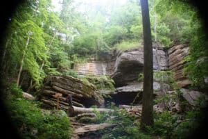
A steep slope led up through trees and bushes. I decided to bushwhack it, so I headed up, crouched over, climbing and crawling until I came to a rock wall. To proceed any further I would have to squeeze through a narrow fissure in the rock. I turned my body sideways and wedged myself through.
On the other side, the slope grew even steeper. The arrow was pointing decisively uphill. I took hold of indentations in the rocks, pulling myself up. Near the top a boulder was blocking my path. Fortunately, it had a large indentation which could afford a decent handhold. I grabbed it and clambered up.
But my weight was too much. The boulder rocked and tipped backwards. Panicked, I lunged for a tree but missed and fell about 8 feet. The boulder came crashing after me, smashing violently through the vegetation, missing me by mere inches.
I lay there cradled in a pocket of rubble and deadfall. I took a long moment to catch my breath and contemplate what had just happened. From there I had two choices. I could continue up or call it a day. I gathered myself and kept going. The lure of random worthless junk had too strong a pull on me.
Unstable?
The slope emerged onto the path known as the Knife’s Edge, a narrow trail heavily overgrown that disappeared around the curve of the mountain as it ascended. I checked the GPS which indicated I should follow the path. So I did.
As I continued the path grew narrower, the drop offs more abrupt. I was 1,857 feet above sea level. A plunge from this height would carry me 50 feet to the rocks below and do major damage to my internal organs. I continued on.
A man appeared, coming at me from around the bend. He was brawny with a ruddy complexion and a bushy white beard. He was wearing a flannel shirt and a camouflage cap. He stopped abruptly in front of me and looked me up and down. “What are you doing up here?” he asked.
I was a little taken aback. “I’m hiking,” I said.
He seemed to mull this over. He stood there, looking away into the distance, chewing. Then he turned and spat. “This mountain is closed,” he said.
“Really?” I asked, playing dumb. “I didn’t know that.”
“Mm-hmm,” he said with a hint of skepticism. “Was that you I heard back there, crashing away, making a ruckus?”
“I’m afraid so,” I said. “A rock came loose.”
“Whole mountain’s unstable,” he said. “You shouldn’t be up here. It’s dangerous. Plus you’re trespassing. Did you know that?”
I feigned ignorance, but I could see he wasn’t buying it. He was staring at me, chewing away. It was making me uncomfortable. “Do you want me to go back?” I asked.
For a moment his features seemed to soften, and then he said, “It doesn’t really matter what I think, does it?”
I was flummoxed by this. Was his question rhetorical or was he challenging me? Did he want me to validate his sense of self worth? Then he asked me again. “It doesn’t really matter what I think, does it?”
“Well, sure,” I said. “Of course it matters.”
He raised one eyebrow. “Really?” Then his expression turned to one of mild amusement. He turned and spat, and then he brushed past me and continued on. I watched him go.
When he was gone, I stood there for a few moments, waiting to see if he would come back. When he didn’t, I went out around the bend to see if he was still there. He was gone.
I waited a couple of more minutes, then carried on. The trail narrowed and ascended higher. It was earning its moniker now. It was the Knife’s Edge.
Finding the Geocache
Although I am not normally afraid of heights, I felt a weakness in the knees and that growing sense of dread that is the precursor to terror. I dared not look down. I kept going. The GPS was telling me I was within a 100 feet of the cache.
With only 40 feet to go, a sapling insinuated its way into my path. I had to grab the trunk and shinny out around it, my heels hanging over the precipice. Fortunately the tree was deeply rooted in the rock. A moment later I was back on the path and within feet of my quarry. I looked around and found it. It took about five minutes.
It would be a violation of the rules of geocaching to tell you where I found the cache, but it is no violation to tell you what was inside of it: a toy truck, some .39 postage stamps, an old leaky battery, and some sticks of gum. There was also the log book, of course, which I signed.
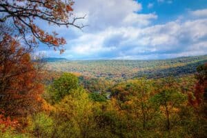
I put everything back and replaced the lid. Then I took a few moments to drink in the scenery before heading down.
By following the Knife’s Edge all the way back, I discovered that I could’ve gotten there by a much easier route. All I had to do was follow the trail to the top and step out beyond a low split rail fence which cordons off the Knife’s Edge from the surrounding overlook. In my impatience I had gotten more thrills than I had bargained for, which wasn’t entirely a bad thing.
It might seem an awfully trivial reward for such a risky endeavor, but geocaching is great sport for people who are going hiking anyway. It adds a dimension of fun and challenge to the hike and gives it a purpose beyond exercise and sightseeing.
The Impenetrable Ozarks

Out back was a graveyard riotously adorned with plastic flowers. Every headstone was draped in them.
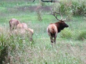
After my hike up the Knife’s Edge, I drove through the mountains, visiting the Buffalo River near Kyle’s Landing, photographing the elk herd in Lost Valley State Park. The Ozarks are lovely and full of many interesting discoveries.
I stopped at a small country church on a remote stretch of road near Mossville. Out back was a graveyard riotously adorned with plastic flowers. Every headstone was draped in them. I could only imagine what had brought on this outpouring of artificial homage, a minister whipping his flock into a frenzy, a half-price sale at the Dollar General store?
The people of the Ozarks are often inscrutable. I saw a man walking down the road carrying a dog on his back. I saw an old timer in overalls sitting outside a country store, sphinx-like, with a half-disassembled television by his side.
As I was driving through the town of Nail, I saw the man who had confronted me on the mountain. I slowed down to be sure he was the same guy, and he looked back at me like he had never seen me before. I gave him a nervous, half-hearted wave, but he registered nothing, conceded nothing. I drove on past.
After tracking down an artificial treasure high in the mountains using a high tech satellite and a global positioning system, I left the Ozarks having penetrated nothing.
Previous stop on the odyssey: Atlanta, GA //
Next stop on the odyssey: Concho, OK
View the Complete Photo Album: Hide-and-Seek on the Knife’s Edge on Flickr
Sources:
- Blevins, Brooks. Review of Hill Folks: A History of Arkansas Ozarkers and Their Image. Southern Cultures. Vol 9, Number 3. Project Muse. Fall 2003. 9 Oct 2011.
- Fox, Dorinda. “How to Spot a Genuine Ozark Hillbilly.” Open Salon. 24 Oct 2008. 9 Oct 2011.
- The History of Geocaching, GPSGames.org, 16 Nov 2010. 9 Oct 2011.
Image Credits:
Stepping on the Knife’s Edge, Robert Ransom; A geocache GPS unit, Malcolm Logan; Contents of a Geocache, Pavel Sevela /Wikimedia Commons; Jasper sign, Malcolm Logan; Downtown Jasper, Malcolm Logan; The Ozark Cafe, Malcolm Logan; The gradual ascent, Andrew Ciscel; The wall of the bluff, Jek in the Box; I came to a rock wall, Jek in the Box; View from the top, Oxherders Art; An official geocache, Solitude; The Buffalo River, Malcolm Logan; The elk herd, Malcolm Logan; Graveyard of plastic flowers, Malcolm Logan





1 comment
[…] stop on the odyssey: Jasper, AR // Next stop on the odyssey: Canton, […]